Light Demand Late This Week but Cool Shots Continue Late March Into April
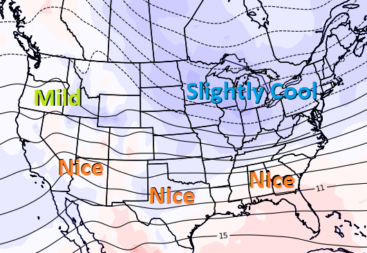
March 22, 2023: The weather data over the past 2-days slowly added 5-8 HDDs, and that continued in the overnight GFS that gained another 3 HDDs. The overnight EC was slightly colder for next week but warmer April 1-4, overall adding a minor 1 HDD. The EC had been a bit colder than the GFS, although the GFS closed the gap the past 48-hours. No major changes to the timing of swings in national demand, w/light national demand Wed-Fri as warm high pressure sets up from Texas to the Northeast w/highs of upper 50s to 80s. There will be a moderate demand this weekend and next week as cool to cold weather systems sweep across the western, central, and northern US. The GFS had been warmer with the set up April 1-4 by seeing a stronger ridge building over the southern and eastern US, although they’re now better aligned after the overnight GFS trended colder for this period, while the EC trended a few HDDs warmer. Both favor cooler than normal weather systems across the Midwest and Northeast April 1-4 (image), although comfortable most elsewhere w/highs of 50s to 80s and why the pattern is considered seasonal to only slightly bullish.