Strong Central US Storm Developing
Strong Springlike Storm To Track Through Central US
A strong springlike storm will bring exciting weather to the central US today and the eastern US tonight and Friday. As the storm continues to strengthen today, a line of heavy showers and thunderstorms will develop ahead of the cold front as it tracks through the south-central US. Strong thunderstorms winds are expected to be the greatest hazard as wind gusts over 40-50 mph are likely as the line of thunderstorms become better organized in the afternoon during peak heating. Heavy snow will fall into the colder air over the Midwest and northern Plains with heavy accumulations of more than 6″ over the Great Lakes region. Today and Friday will be the warmest day of the “big” warm spell for the Northeast as southerly winds out ahead of the storm bring milder temperatures. The warm up will be so impressive that NYC may spike into the 50s tomorrow afternoon ahead of the cold front for like 5 or 6 hours. A prolonged, impressive warm up indeed. The storm will track through the east tomorrow with areas of moderate to heavy precipitation and gusty winds ending the warm up late in the day. Cold air filtering around on the back side of the storm will allow temperatures to cool to near or below normal for much of the northern US by Friday night. The cold is not all that impressive but will open the door for a much colder blast to follow Sunday and Monday.
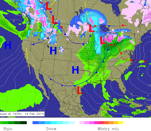
Today’s Weather: A massive springlike storm will be tracking through the central US with showers and thunderstorms ahead of the cold front and heavy snow into the Great Lakes. This powerful storm will track into the eastern US Friday. The “big” warm up is almost already over as cold air will be filtering in on the backside of the storm. The northwestern US will continue to see a moist Pacific flow.
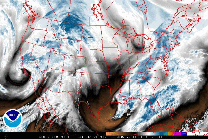
The satellite image shows a strong springlike storm tracking through the central US today with showers and thunderstorms developing ahead of the cold front. The water vapor satellite loop shows a nice cyclone wrapping up as the center of the low tracks through Missouri and toward the Ohio Valley region. A few things to note: 1) The massive area the storm encompasses as it pushes a strong warm front toward the Northeast with a training cold front all the way to Texas. On the back side of the circulation, colder air is being drawn through the northern Rockies and will sweep through the Plains and Midwest overnight. The storm will then track into the Northeast tonight and Friday.
The Doppler radar loop shows disorganized areas of showers over the southern US with some snowfall into the Midwest. As the day progresses a more consolidated precipitation shield will set up over the central US with a line of strong showers and storms developing in the afternoon.
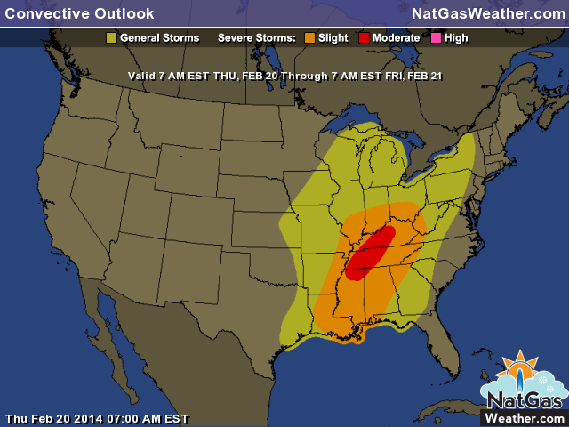
Strong Thundestorms are expected to develop today ahead of the storms cold front. Some storms could be severe with the main threat being damaging winds.
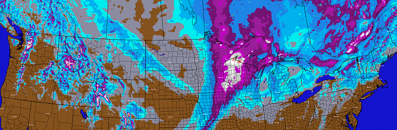
The image shows snowfall accumulations over the next two days. The Great Lakes region will see the heaviest snowfall amounts as the storng winter storm barrels through. Amounts into the purples and whites are more than 6″ of snowfall. Temperatures will actually relatively mild compared to late even though heavy snow will be falling.