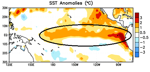
Sea Surface Temperatures have become warmer than normal over a long stretch of the equatorial Pacific Ocean. The image shows this nicely within the black circle and then down the west coast of South America. Warm SST’s lead to stronger convection and influence hemispheric weather patterns that shift areas of high and low pressure. El Nino conditions favor less hurricane activity over the Atlantic, but more over the Pacific in the summer. In the Winter, El Nino favors a wetter southern California and the southern US, while milder over many northern and eastern regions.
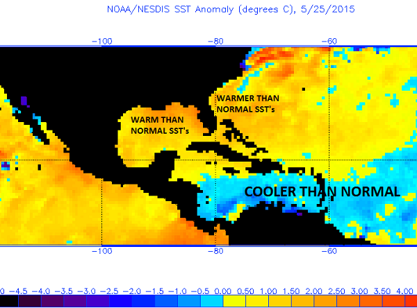
The image shows recent Sea Surface Temperature anomalies. SST’s are warmer than normal over the Gulf of Mexico and along the East Coast, which could lead to slightly warmer temperatures as well as higher humidity, especially near the coast. This could also help fuel any tropical systems that track through. However, there’s also a wide swath of cooler than normal temperatures over the Caribbean and central Atlantic, which is where tropical waves coming off Africa track. With cooler than normal temperatures, which could be aided by El Nino, tropical development would be less favorable over this region.
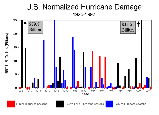
The image shows hurricane damage in billions of dollars during El Nino, neutral, and La Nina years. El Nino years are in red and typically don’t have much damage. There were 3 years that did bring decent damage in the 1960s and early 70s, but it tends to be less than the other ENSO states.