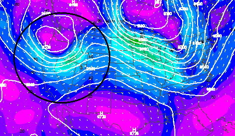
The image shows the overall upper level weather pattern on August 1st, 2013. Most importantly, an unseasonably strong summer weather system was tracking across northern Nevada with a sharp cool front. There wasn’t any precipitation over Nevada as a result of it, but it did produce strong gusty winds. Ahead of the cool front, where the accident occurred, southerly winds were quite strong and would be expected in this type of weather pattern, making it no surprise forecasts were calling for gusty afternoon winds of around 30 mph.
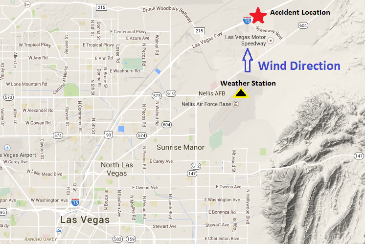
The image shows the location of the accident in relation to Las Vegas and terrain to the southeast. Most importantly, the orientation of Interstate-15 is quasi east-west, making it susceptible to strong south winds. A vehicle in the southbound passing lane would be forced northward if acted upon by strong gusts. In addition, the location of the weather station at Nellis Air Force Base in north Las Vegas used in the analysis is also depicted.
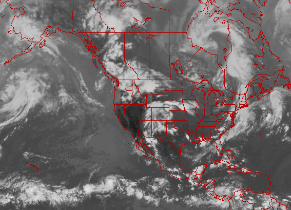
The satellite image around the time of the accident showed clear skies. This shows there were not rain or showers in the area that could cause strong outflow winds.
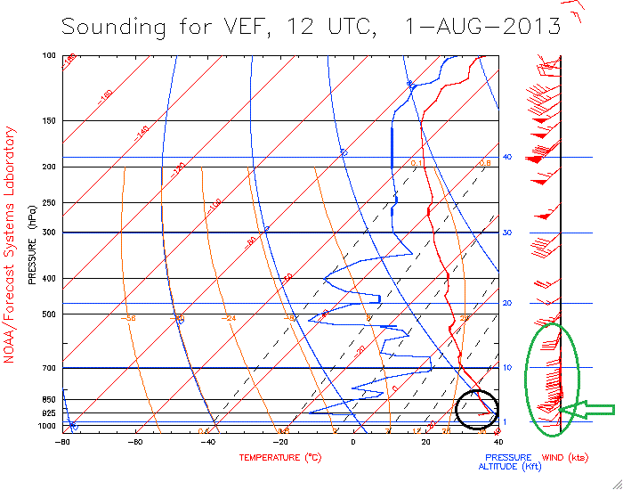
The image shows data from a weather balloon released from the National Weather Service in Las Vegas on the morning of August 1st, 2013. What is important is it shows a temperature inversion at the surface as cooler overnight air pooled on the valley floor (red line in black circle). However, it was much warmer just above it. Once the sun warmed the surface, temperatures increased, causing the inversion to break, depicted as the black circle. Once the inversion breaks much stronger winds off the surface will mix down from several hundred feet off the ground. You can see this as the green circle just to the right of the black one. The bottom wind barbs are closest to the surface and show winds around 5-10 knots. However, just above they rapidly increase to 20-30 knots just above the inversion. The image reads at the bottom as the surface and the top as very high up in the atmosphere. Most importantly, the sounding confirms there will be strong winds coming in the afternoon with the potential for dust devils to form once the inversion breaks in the early afternoon.