By natgasweather
Overnight 0z ECMWF Model Trends Notably Colder
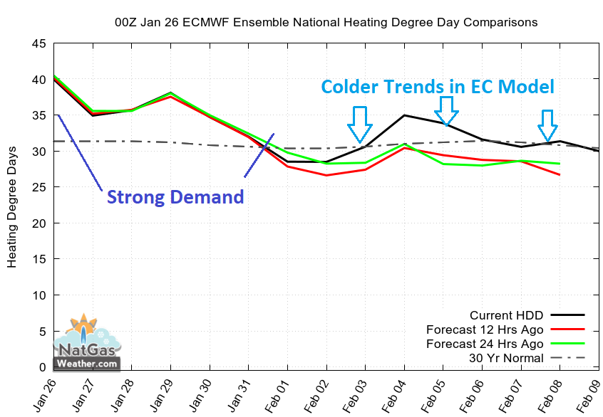
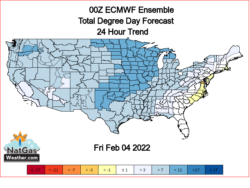
As we mentioned Tuesday afternoon, there were large differences between the colder GFS model for the first week of February compared to the much warmer ECMWF model and whichever proved more correct, prices would likely spike in that direction. Well, the GFS proved to be the better model in this situation as the overnight EC spiked a massive 24 HDDs by seeing colder trends across the northern, central, and eastern US Feb 3-8. The EC still isn’t quite as cold as the GFS but did take a big step in that direction overnight. But will the midday GFS and afternoon EC hold this colder trend and not reverse warmer, especially when considering the weather data has been inconsistent on the early February pattern going back to last week.