Near Average Weekly Nat Gas Build Expected
A Slow Moving Spring Storm Kept Perfect Nat Gas Build Weather From Occurring Last Week
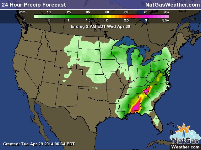
The weather during last weeks nat gas build included a slow moving spring storm that brought numerous days of showers and storms to the central and eastern US as well as a decent cool blast that pushed deep into the southern US. This led to overall cooler than normal conditions over much of the US. It took much of the cool front to push past the southeastern US which allowed mild temperatures to be observed for much of the week. Other than the southeastern US, only the West coast experienced below normal temperatures. Analyst estimates for the coming week generally range in the +70-75 Bcf build for the Thursday morning EIA storage release which is slightly higher than the 5 year average of +64 Bcf. This would be nearly the same as last week, however, cool temperature anomalies were more widespread and impressive compared to the previous week along with plenty of cloud cover and rainfall. This could all lead to a lower than ex[ected build. The following images highlight the important weather conditions over the past week as well as the temperature anomalies. I included the previous weeks temperature anomaly and you will see it was much colder for the coming draw, yet projections are near the same. That gives us a cool lean to the coming report, although anything is possible during the shoulder season when the numbers some times don’t add up. Next weeks build will be higher as we factor in this the early week warmth, but next week will be factoring another cold trough over the central and eastern US. This will again delay hefty builds and keep supplies from making up rapid ground on the nearly 1.0 Tcf deficit as we approach June.
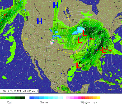
All of last week a slow moving weather system tracked out of the central US and into the east with heavy rains, severe thunderstorms, and a cool blast that pushed deep into portions of the southern US. Temperatures dropped during the nights into the 30s and 40s for many regions for many days. This led to some decent heating demand. High pressure over the western US led to mild conditions.
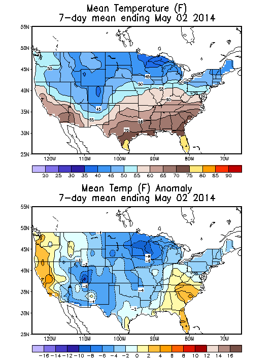
Average temperatures for the week were quite chilly across the northern US with average temperatures in the 30s and 40s. More importantly is the lower image which shows cooler than normal conditions impacted much of the US apart from the Southeast and West coast. This led to higher than normal demand deep into the US and could lead to a lighter nat gas build than the markets may be expecting.
.
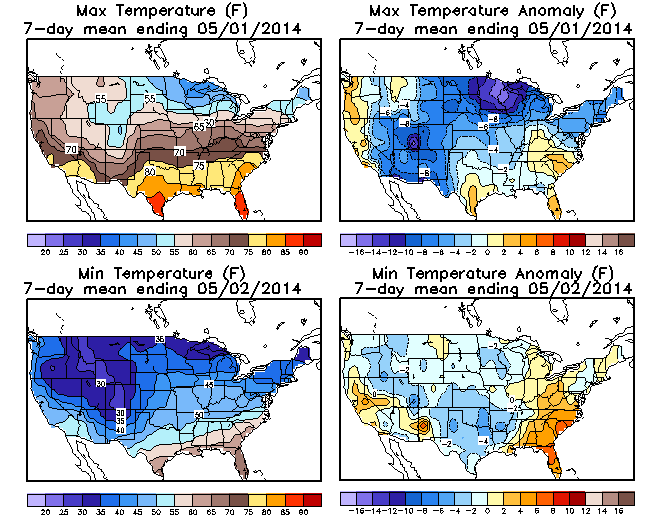
The image shows the average highs and lows for the week spanning the build period. Note chilly overnight lows of 30s and 40s occurred over many regions which is fairly significant to be averaged over an entire week. The stronger sun angle and longer days do limit the intensity of the cold and the number of hours heating is needed.


